Tamil Nilam
GI Viewer – Land Intelligence PlatformTamil Nilam – GI Viewer
Explore Tamil Nadu land parcels with real-time GIS intelligence. Access survey details, boundaries, ownership records, and spatial layers — all in one interactive platform.
What is Tamil Nilam – GI Viewer?
Tamil Nilam – GI Viewer is an advanced Geographic Information System (GIS) platform that provides real-time access to land parcel data across Tamil Nadu. It integrates survey boundaries, ownership details, and spatial layers into a unified digital experience.
Designed for citizens, government officials, and stakeholders, the platform ensures transparency, accuracy, and ease of access to critical land information.
Statewide Access
Access land records across Tamil Nadu with seamless GIS integration.
Instant Data
Retrieve land information instantly with real-time system performance.
Trusted Platform
Built for accuracy, transparency, and government-grade reliability.
Start Exploring Tamil Nadu Land Records
Access survey maps, ownership details, and GIS layers instantly.
Powerful GIS Capabilities
Explore advanced tools designed for accurate land insights, mapping, and real-time spatial intelligence
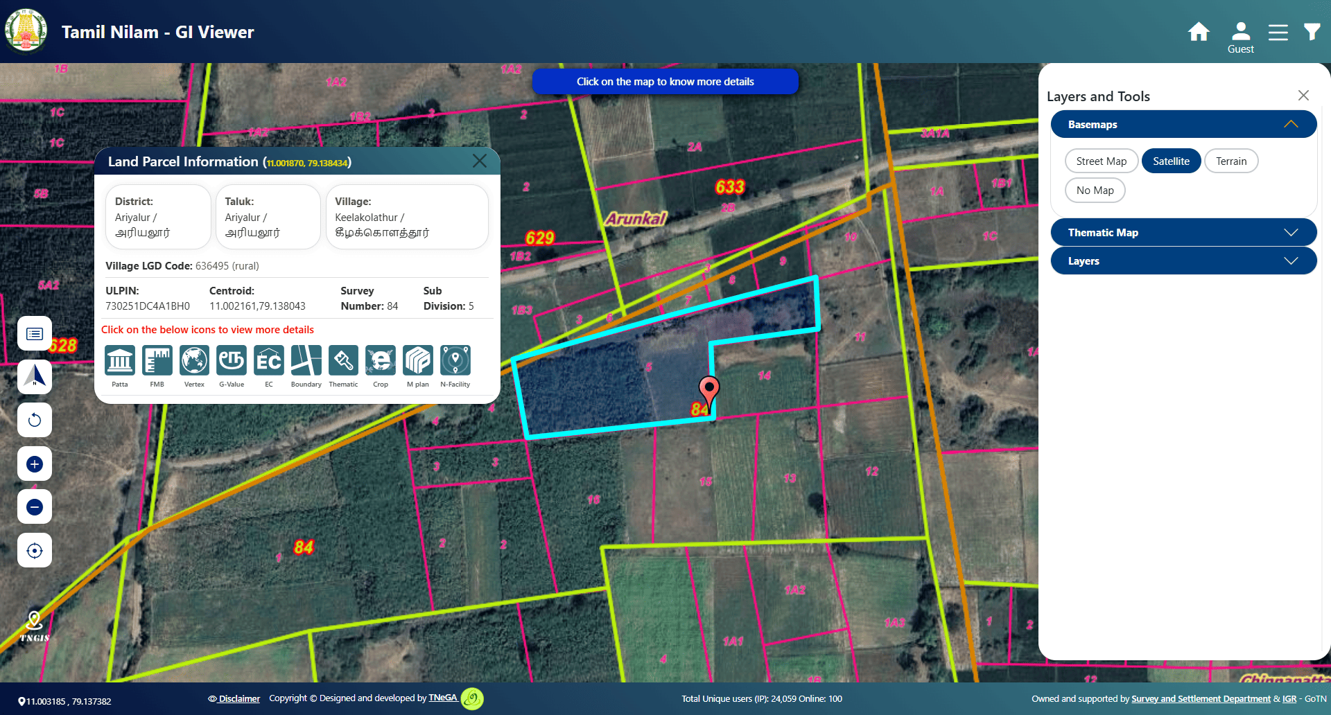
Interactive GIS Map
Explore land parcels with real-time spatial visualization.
Search by Survey / Patta
Locate land instantly using survey numbers or patta details.
Multi-Layer Data
View boundaries, roads, amenities, and classifications.
FMB & Patta Access
Access ownership and field measurement details instantly.
Nearby Facilities
Locate infrastructure like hospitals, roads, and public services.
Frequently Asked Questions
Everything you need to know about Tamil Nilam – GI Viewer
Contact Us
Reach out for support, queries, or technical assistance
Get in Touch
tngis.support@tn.gov.in
+91-44-40164907/+91-44-40164999
2nd & 7th Floor, P.T. Lee Chengalvaraya Naicker Building807, Anna Salai (Mount Road)Chennai - 600 002